


Greizer Htte-Berliner Htte on GPSies.com

fpolini
User

Length
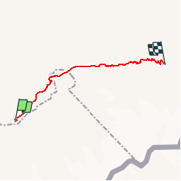
8.9 km

Max alt
2875 m

Uphill gradient
1224 m
Km-Effort
25 km

Min alt
1803 m

Downhill gradient
1056 m
Boucle
No
Creation date :
2019-06-08 19:24:52.979
Updated on :
2019-06-08 19:30:38.998
4h47
Difficulty : Very difficult

FREE GPS app for hiking
 SityTrail
IGN / Geographical institutes
SityTrail Plus
The world is yours!
About
Trail Walking of 8.9 km to be discovered at Tyrol, Bezirk Schwaz, Marktgemeinde Mayrhofen. This trail is proposed by fpolini.
Positioning
Country:
Austria
Region :
Tyrol
Department/Province :
Bezirk Schwaz
Municipality :
Marktgemeinde Mayrhofen
Location:
Unknown
Start:(Dec)
Start:(UTM)
713726 ; 5211737 (32T) N.
Comments